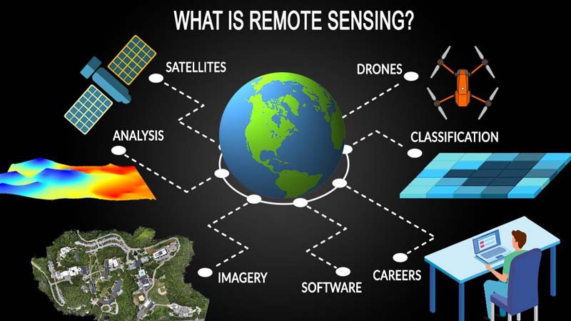
What is Remote Sensing Technology?
Remote sensing technology is useful for acquiring data about the earth’s surface and to investigate its physical characteristics. It uses emitted and reflected light from the aircraft and satellites without the need for physical contact with the region of the surface under examination.
The remote sensing industry is chiefly fuelled by the increasing number of earth observation projects by numerous space-related agencies. For instance, the Indian Space Research Organization (ISRO) has 13 satellites associated with earth observation to date and it plans to introduce 10 earth observation satellites during the years 2020-2021.
Types of Remote Sensing Technology
1. Active Remote Sensing
The segment of active remote sensing is expected to be the major holder of the share of revenue of the industry. This type of technology is known to radiate its very own light to screen and examine the surface qualities.
Active remote sensing is considered to defeat the disadvantages of passive remote sensing i.e. this cannot be used to analyze qualities of the surface during the night. The technology of active remote sensing is extensively used for assessing the structure of the forest, ice, and ocean surface topography.
2. Passive Remote Sensing
The segment of passive remote sensing holds the highest revenue share of the industry. The technology of passive remote sensing is considered to assess the reflected sunlight from the surface of the world to screen and examine the features of the surface.
Passive remote sensing is known to give high-quality images from satellites and therefore is widely used for various earth observation applications.
Potential Application of Remote Sensing Technology
1. Military and Intelligence
The segment of military and intelligence holds a significant share of revenue of this industry. This is due to the fact that the growing adoption of this innovation by developed countries to monitor and prevent criminal and other negative activities. Additionally, nations, for example, China and Russia are focusing on utilizing images from satellites for defense applications. All these components are considered to boost the demand for remote sensing technology in the next few years.
2. Disaster Management
The segment of disaster management holds a major revenue share of the industry. The technology can provide imperative information associated with natural disasters, for example, storm and volcano eruptions. The availability of continuously updated data assists authorities with making better decisions related to evacuations and initiatives to be taken after the disaster.
3. Aerial Systems
These days, there is wide use of a drone or Unmanned Aerial Vehicle (UAV) in the sector of aerial mapping. This makes the aerial systems segment a major holder of the revenue share of the industry. The use of drones in surveying fields reduces the cost and assists with gathering data at a fast rate. Additionally, surface mapping over these instruments give highly precise data and investigate the area that cannot be analyzed over satellites.
4. Satellite
There has been increasing earth observation ventures by major space agencies such as NASA. Moreover, the rising adoption of images based on satellites for weather forecasting is another element that is expected to fuel the demand for remote sensing technology in the upcoming years. Meteorological satellites can estimate the winds near the surface of the sea from space, which is very useful for locating and monitoring cyclones.
Merits of Remote Sensing Technology
- Remote sensing technology allows the simple and easy collection of information over multiple scales and resolutions.
- Data that is acquired by remote sensing can simply be processed and analyzed quickly utilizing a computer and the data can be utilized for numerous purposes.
- Remote sensing technology allows revision of maps at a small to medium level which makes it less costly and faster.
- It becomes really simple to locate the fire in the forest and flood that has spread over a massive region which makes it easier to initiate a rescue plan in a fast and easy manner.
Demerits of Remote Sensing Technology
- Remote sensing is a comparatively expensive method of analysis, especially when calculating or analyzing smaller regions.
- The instruments used in remote sensing may a few times be badly calibrated which may lead to inaccurate data.
- In some cases, large-scale engineering maps could not be acquired from satellite data which makes data obtained from remote sensing incomplete.
- It is expensive to investigate repetitive pictures if there is a need to examine various aspects of the photography features.
Summing Up:
Remote sensing is known to be useful in obtaining data from the surface of the earth and it has applications in various fields. The remote sensing technology can be segmented into two types namely active remote sensing and passive remote sensing.
Remote sensing technology has its applications in different fields such as military and intelligence, disaster management, aerial systems, and satellites, etc. Moreover, there are some merits and demerits of remote sensing technology.
Comments